
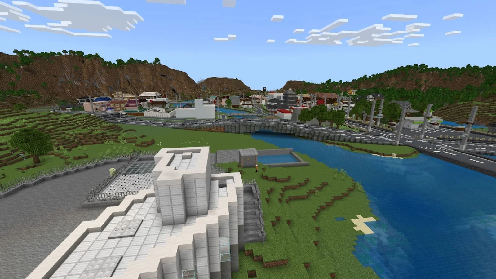
Someone at Japan’s Ministry of Land, Infrastructure, Transport and Tourism (MLIT) has mad Minecraft skills and time to spare. Earlier this month, the MLIT’s official YouTube channel released a video showing off an elaborate Minecraft recreation of a real-life, massive underground flood control facility located in the Greater Tokyo Area. The map has since been released for free, and I had to go in and check out this unusual project.
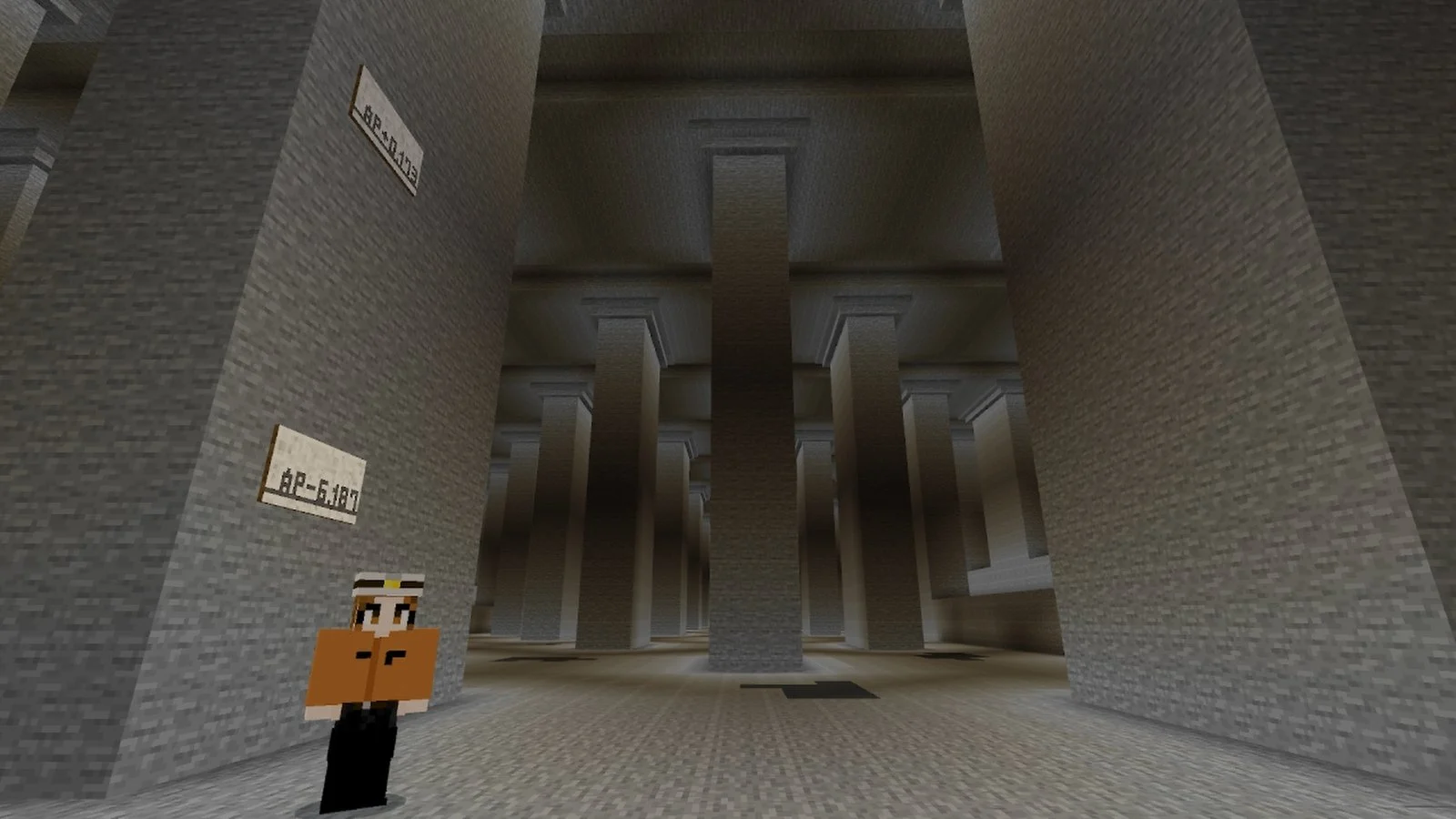
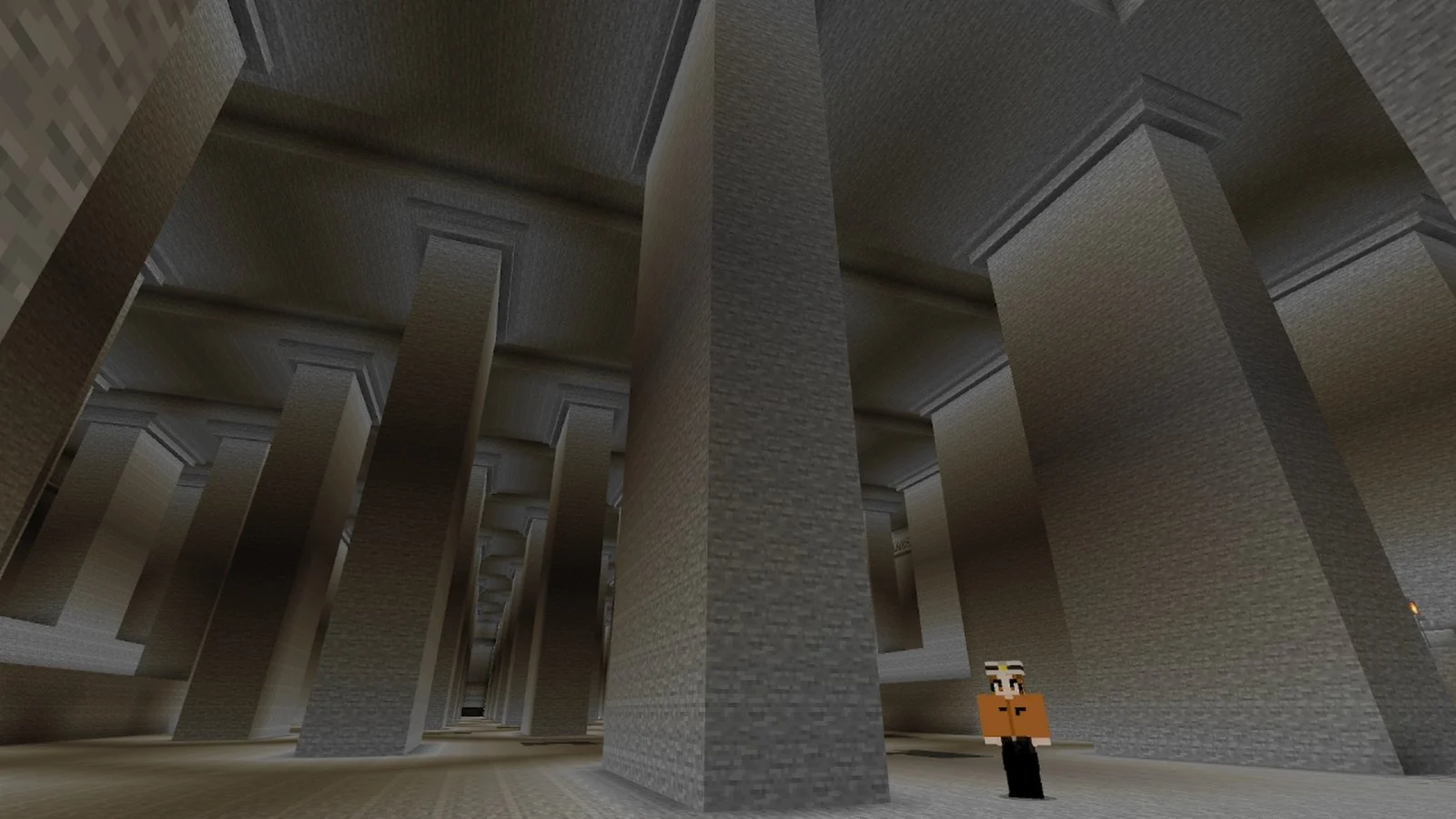
Japan’s “Metropolitan Area Outer Underground Discharge Channel,” also called G-Cans, is the world’s largest underground flood control facility. It helps prevent floods and landslides by controlling river water levels; but aside from being useful against disasters, it’s also kind of famous for its vibes. Its most iconic area is the huge underground chamber, which is supported by massive pillars and known to have a dark and mysterious, temple-like appearance. Japanese people also refer to it as an “Underground Temple of Disaster Prevention.”
But why did the Japanese government decide to invest in fully recreating the facility in Minecraft? The MLIT wants to promote G-Cans not only as a form of disaster-prevention awareness, but as a tourist attraction too. The Minecraft world will be used for an educational program called the “Minecraft Disaster Prevention Learning Course” at facility tours starting in June. But since the MLIT has generously put it up for free download, I had to check it out for myself.

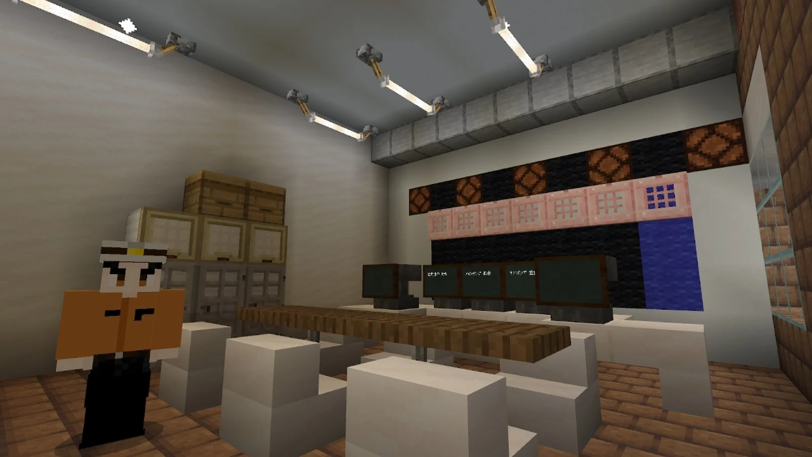
As soon as I arrived in-game, I was greeted by staff at the entrance. NPCs representing staff and visitors were scattered throughout the map, and I could talk to them all. A guide in the second-floor exhibit room taught me about what the facility actually does. Apparently, it’s been activated over 100 times and has prevented an estimated 1.5 trillion yen (about $10.4 billion USD) worth of damage. I also received a handy compass that let me warp to anywhere in the world.
I headed straight to the iconic pressure control tank (the one likened to a temple). Its towering pillars looked just as majestic in Minecraft, recreating the monumental atmosphere quite accurately. According to the guide, the pillars not only support the ceiling but also keep the tank anchored so it doesn’t float due to groundwater. Each one weighs about 500 tons, which is crazy.
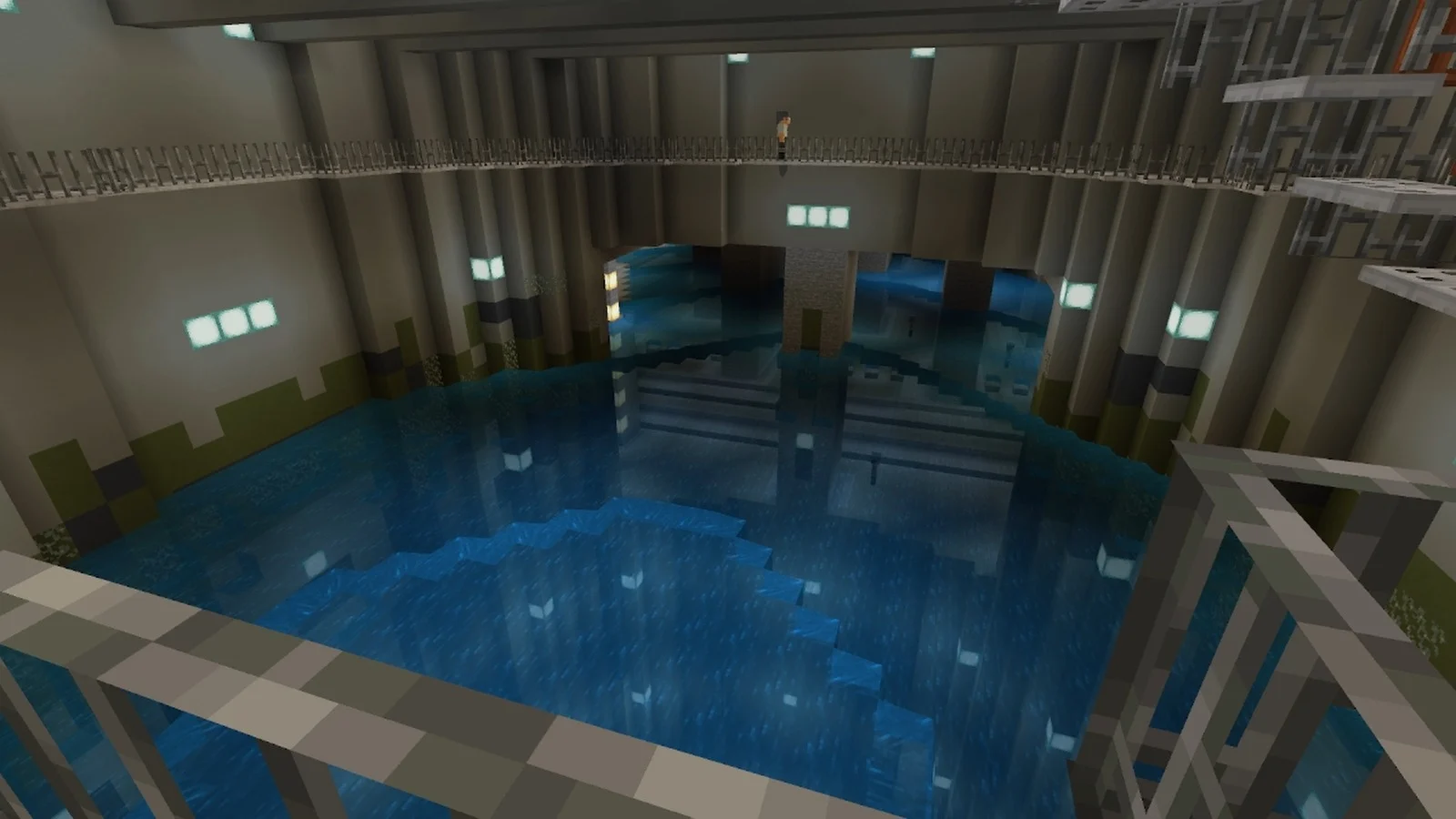
At the back of the exhibit area, I found the central control room. This is where the entire facility is monitored via cameras, and systems like floodgates and pumps are controlled. When I pushed a button to open one of the shaft gates, water started flowing in, and the water level gradually rose. Eventually, the tank filled up completely. In real-life tours, you can only see this happen under specific conditions, like during heavy rain that’s not heavy enough to warrant the tour being cancelled. But in Minecraft, you can watch it happen anytime, which I found pretty neat.
The world also includes other areas like the pump room and third shaft; all recreated with an equally impressive attention to detail. There’s a lot to explore. One part I especially appreciated was how the surrounding neighborhoods protected by the facility were also included in the map. It really shows how much care and thought went into this project.
The MLIT’s Minecraft map can be downloaded for free from the Edogawa River Office homepage. It works with Minecraft Bedrock version 1.21.1 and Education Edition 1.21.03 and beyond. You can play it on PC, iOS, and Android by loading up the world data directly. For other platforms, you’ll need to load the map on a PC first and then upload it to a multiplayer server.


Can I have the map code pls
Maybe normalise reading the whole content before commenting … Or does your attention span not suffice for such a task?
Can I have the map please 🥺
It’s soo skibidi
This is good
Bhai aap konsa Minecraft khelte ho please 🥺 mujhe bata do
Wow
Please give Minecraft game to me
67
Map Code please!! I need this Space for Farms.